


Courthouse Voting District, Botetourt County, Virginia
About
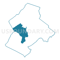
Outline

Summary
| Unique Area Identifier | 681187 |
| Name | Courthouse Voting District |
| County | Botetourt County |
| State | Virginia |
| Area (square miles) | 52.16 |
| Land Area (square miles) | 51.99 |
| Water Area (square miles) | 0.17 |
| % of Land Area | 99.68 |
| % of Water Area | 0.32 |
| Latitude of the Internal Point | 37.53578520 |
| Longtitude of the Internal Point | -79.88874880 |
Maps


Graphs
Select a template below for downloading or customizing gragh for Courthouse Voting District, Botetourt County, Virginia


Neighbors
Neighoring Voting District (by Name) Neighboring Voting District on the Map
- Asbury Voting District, Botetourt County, VA
- Barbours Creek Voting District, Craig County, VA
- Eagle Rock Voting District, Botetourt County, VA
- Mill Creek Voting District, Botetourt County, VA
- North Mountain Voting District, Craig County, VA
- Oriskany Voting District, Botetourt County, VA
- Springwood Voting District, Botetourt County, VA
- Town Hall Voting District, Botetourt County, VA
- Troutville Voting District, Botetourt County, VA
Top 10 Neighboring County Subdivision (by Population) Neighboring County Subdivision on the Map
- Amsterdam district, Botetourt County, VA (7,596)
- Fincastle district, Botetourt County, VA (6,753)
- Buchanan district, Botetourt County, VA (6,306)
- Potts Mountain district, Craig County, VA (1,071)
- Craig Creek district, Craig County, VA (1,003)
Top 10 Neighboring Place (by Population) Neighboring Place on the Map
Top 10 Neighboring Unified School District (by Population) Neighboring Unified School District on the Map
Top 10 Neighboring State Legislative District Lower Chamber (by Population) Neighboring State Legislative District Lower Chamber on the Map
Top 10 Neighboring State Legislative District Upper Chamber (by Population) Neighboring State Legislative District Upper Chamber on the Map
Top 10 Neighboring 111th Congressional District (by Population) Neighboring 111th Congressional District on the Map
Top 10 Neighboring Census Tract (by Population) Neighboring Census Tract on the Map
- Census Tract 403.02, Botetourt County, VA (7,567)
- Census Tract 501, Craig County, VA (5,190)
- Census Tract 402, Botetourt County, VA (4,294)
- Census Tract 401, Botetourt County, VA (3,498)
- Census Tract 403.01, Botetourt County, VA (2,954)
- Census Tract 404.01, Botetourt County, VA (2,201)